
AI Data Engineering Solutions
Transform Raw Data Into Intelligent Training Datasets with Expert-Led Precision
We transform complex image, video and multimodal sensor data into high-quality, structured datasets that power AI development. Through data collection, curation, processing, enrichment and quality validation, we build reliable data foundations for intelligent systems across industries.
Milestones & Metrics
Supporting AI data projects across automotive, sports, agriculture, retail, and construction.
Accuracy
Four-tier quality assurance through automated validation, expert review, peer checks and final audits.
systems.
Specialists
Skilled teams supporting complex data workflows across autonomous mobility, sports and agriculture.
Delivery Rate
Consistent delivery through structured workflows and Human-in-the-loop (HITL) quality controls.
AI Data Engineering Capabilities
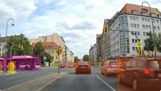
Image & Video Annotation
Transform raw visual data into accurately labeled training datasets that fuel high-performing computer vision models. Our expert annotation teams specialize in everything from object detection and semantic segmentation to complex scene analysis, ensuring pixel-perfect precision across all camera modalities and image formats.
- Image & Video Data Annotation Services - Annotation Types:
2D Object Detection
Bounding boxes with tight-fit methodology, polygon segmentation, and instance segmentation.
Semantic & Instance Segmentation
Pixel-level classification for roads, vegetation, objects, meat quality, fish bodies.
Action Recognition
Sports events, construction activities, worker safety, behavioral analysis.
Keypoint & Pose Estimation
15-point anatomical mapping (fish, human pose), player tracking, skeletal annotation.
Object Tracking
Temporal tracking with unique IDs, ball trajectory, player movement, equipment utilization.
Quality Assessment
4-tier image quality classification (Poor, Fair, Good, Excellent) for facial recognition datasets.
LiDAR & Sensor Fusion Annotation
Unlock the full potential of 3D point cloud data with expert LiDAR annotation services. Our specialists label millions of 3D points with precision, enabling accurate depth perception, object detection, and spatial understanding for autonomous systems. We seamlessly integrate LiDAR data with camera and RADAR inputs for comprehensive sensor fusion annotation.
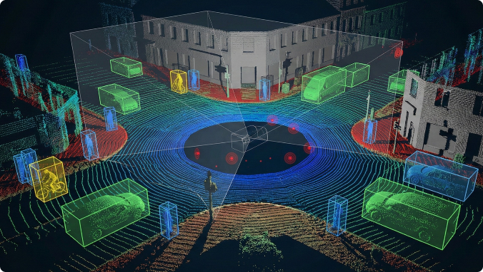
- LiDAR & Sensor Fusion Data Annotation Services - Annotation Types:
3D Bounding Cuboid Annotation
Precise 3D boxes with dimension-based classification, tight bounding following "single box per object" rules, ISO-standardized cuboids.
Object Tracking & Trajectory
Temporal tracking with unique IDs, smooth trajectories, motion physics validation.
Multi-Sensor Fusion
Synchronized annotation across:
- LiDAR + Camera (3D cuboids projected onto images)
- LiDAR + RADAR (spatial + velocity)
- Triple Fusion (LiDAR + Camera + RADAR + Thermal) for complete 360° perception
Semantic Segmentation
Point cloud classification for surfaces (roads, sidewalks, vegetation), objects, infrastructure.
2D-to-3D Mapping
Mapping 2D bounding boxes to 3D representations for comprehensive data utility.
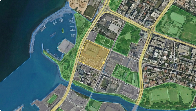
RADAR & Geospatial Annotation
Enable precise object detection and perception understanding in challenging conditions with expert RADAR and geospatial annotation. RADAR data excels in adverse weather and low-visibility scenarios, while geospatial annotation unlocks insights from satellite and aerial imagery. Our specialists handle the unique challenges of RADAR signal interpretation and large-scale geographic data labeling.
- RADAR & Geospatial Data Annotation Services
RADAR Annotation Services:
- RADAR + Camera Fusion - Synchronized annotation across RADAR detections and camera images.
- Signal Classification - Target vs. clutter discrimination, interference rejection
- Weather Condition Classification - Environmental factors affecting RADAR performance.
- Geospatial Annotation Services:
- Land Use & Land Cover
- Building & Infrastructure Detection
- Change Detection
- Precision Agriculture
- Disaster Assessment
- Environmental Monitoring
- Urban Planning
Industries We Serve
Why Choose rProcess?
Trained specialists across 10+ industries including automotive, agriculture, construction, logistics, robotics, retail, aquaculture, and environmental mapping.
We deliver domain-informed annotations that enhance model accuracy — not generic, one-size-fits-all labeling.
From pixel-level segmentation to 3D cuboids and multi-modal fusion, rProcess provides full-spectrum annotation across:
- Images & video
- LiDAR
- RADAR
- Thermal/IR
- Aerial & satellite imagery
We follow ISO-standard conventions and client-defined rules:
- Single box per object
- Tight bounding rules
- Minimum LiDAR/RADAR point rules
- Consistent IDs and coordinate frames
We excel at annotating challenging data involving:
- Night, fog, rain, glare, low-light
- Occlusions
- Vulnerable road users
- Cluttered agricultural or industrial environments
We deliver:
- 1M+ images monthly
- 50K+ video hours
- 100K+ LiDAR frames
- 10,000+ sq km geospatial imagery
- Expert review
- Automated validation
- Model-assisted verification
- Domain audits
- Continuous feedback
We ramp 50+ trained annotators in 48–72 hours.
Supports JSON, CSV, XML, PCD, LAS/LAZ, BIN, PLY, ECEF, UTM, vehicle frames.
AI Data Engineering Case Studies

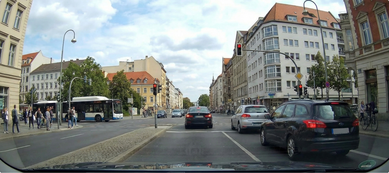
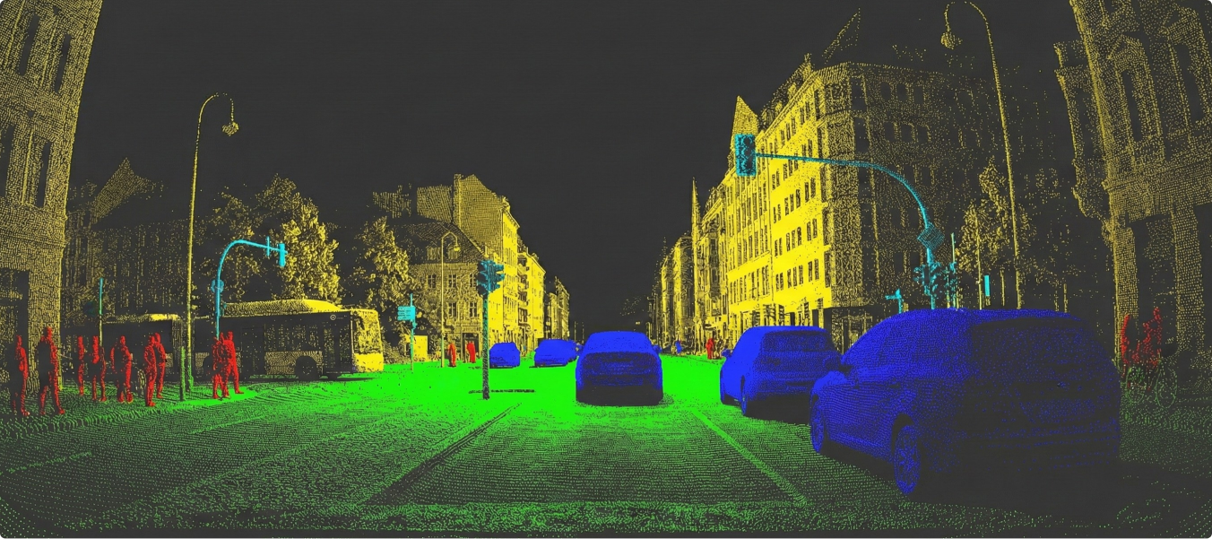
Autonomous driving models require accurate segmentation of LiDAR point clouds to identify both static and dynamic objects within a defined range of interest. The challenge lies in annotating complex scenes with multiple object types (vehicles, traffic signs, vegetation, obstacles, etc.) while addressing data noise (reflections, blooming, scan errors) and ensuring high-quality outputs at scale.

- Scaled workforce from 20 → 140 annotators.
- 20-day structured training & onboarding.
- Offline LiDAR annotation tool for objects & noise categories.
- 1:4 QA-to-annotator ratio for quality control.

- Segmented objects accurately within 100–250m RoI.
- Maintained error rate at 18.5 errors/task (better than <20 target).
- Delivered 100,000+ annotated frames for autonomous driving models.
- Achieved 98%+ dataset reliability through multi-level QA.
- Established a scalable pipeline supporting rapid workforce expansion and consistent delivery.
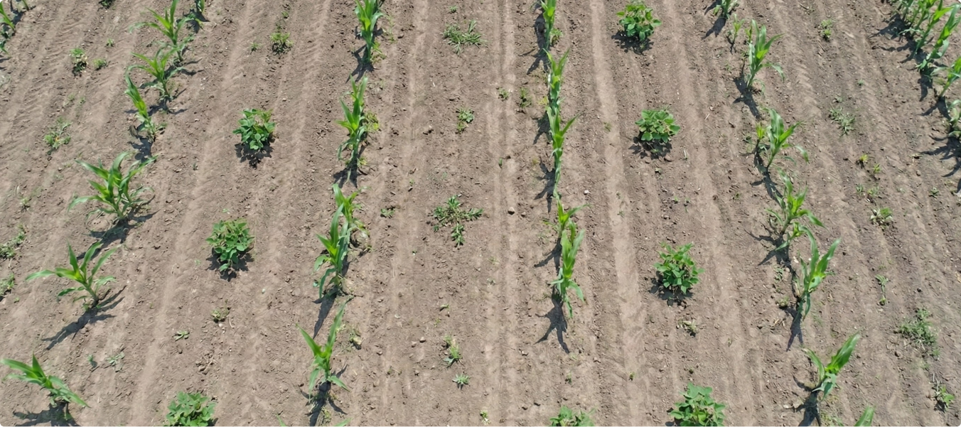
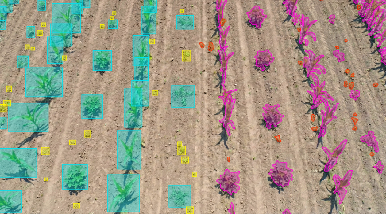
Efficient farming requires distinguishing crops from weeds to optimize chemical usage. Traditional blanket spraying methods waste resources, increase costs, and damage the environment. There was a need for high-quality labeled datasets to train AI-powered See & Spray technology that targets weeds precisely.
- Labeled farm images to differentiate Soybean and Corn crops from weeds.
- Applied segmentation (15 mins per image) and bounding box annotation (3 mins per image) to ensure accurate classification.
- Created structured datasets enabling machine learning models to guide smart sprayers.
- Successfully annotated 500,000 images.
- Delivered high-accuracy segmentation and bounding box datasets.
- Enabled AI-driven spraying systems to reduce chemical use, cut costs, and support sustainable farming.
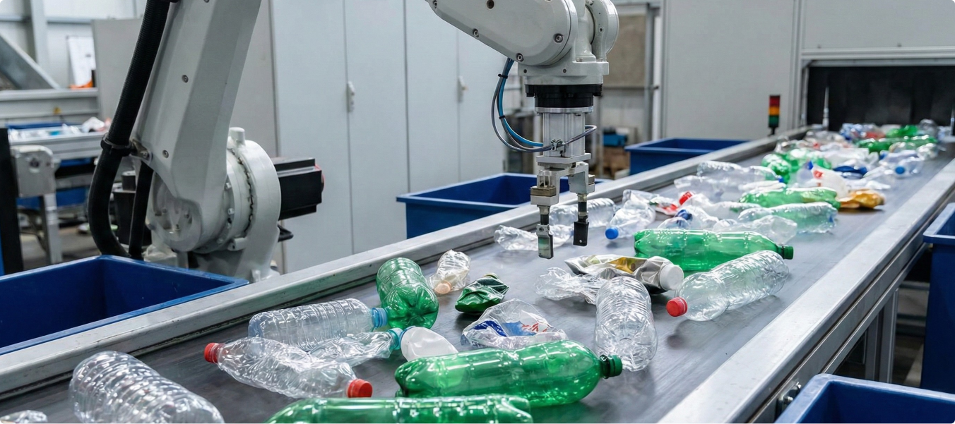
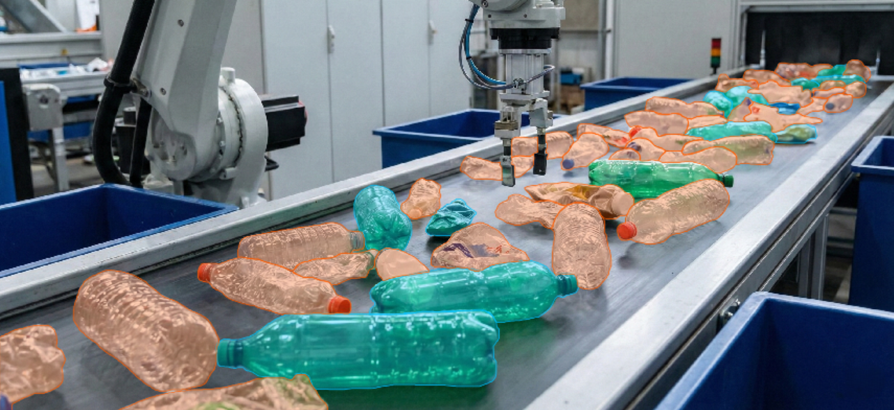
rProcess partnered with a leading AI and robotics company to revolutionize recycling economics. The project focused on creating high-quality annotated datasets to train machine vision models for automated waste segregation in Municipal Solid Waste (MSW), Construction & Demolition (C&D), E-Waste, and battery recycling.
- Developed a large dataset with precise segmentation and labeling of waste objects.
- Applied AI, computer vision, and smart sorting system workflows.
- Delivered facility-wide data insights for material purity, performance, and waste characterization.
- Supported design of robotics systems for targeted segregation of high-value commodities.
- Enabled the creation of machine learning models for accurate waste classification.
- Annotated 350 diverse datasets from industries such as manufacturing, C&D, electronics waste, and MSW.
- Supported automated robotics for safe, efficient, and precise segregation.
- Improved recovery of recyclable materials, reducing landfill dependency.
- Provided scalable annotation workflows for multiple waste domains.
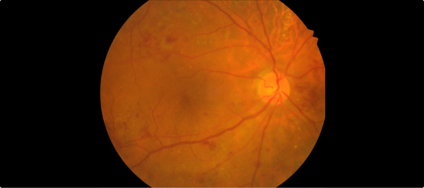
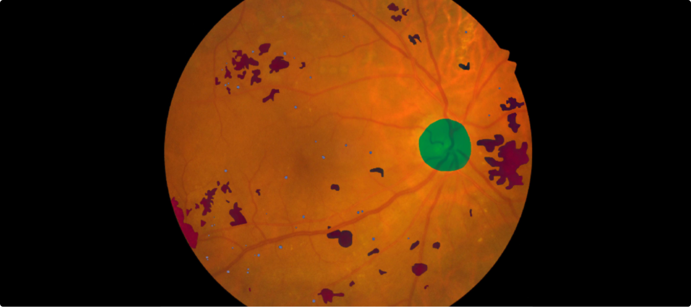
Accurate annotation of retinal fundus images is critical for detecting and classifying Diabetic Retinopathy (DR) and Diabetic Macular Edema (DME). The challenge lies in ensuring pixel-level precision to enable reliable model training for ophthalmology applications.
- Deployed an on-demand data annotation model for high accuracy.
- Performed pixel-level labeling of lesions to capture fine details.
- Supported the client’s goal of advancing AI-powered diagnostic solutions in healthcare.
- Annotated ~1,000 retinal images, ensuring precise classification of DR and DME lesions.
- Delivered a high-quality annotated dataset for ophthalmology AI models.
- Enabled accurate detection and segmentation of DR and DME.
AI Data Engineering – FAQs
What types of data does rProcess support?
We work with images, videos, LiDAR point clouds, RADAR signals, geospatial and satellite imagery, drone footage and multimodal sensor datasets across industries such as automotive, agriculture, retail, sports, construction and healthcare.
What AI data engineering capabilities do you offer?
Our capabilities include data collection, curation, processing, enrichment, object detection, semantic segmentation, classification, tracking, 3D data processing, sensor fusion and quality validation. We align our workflows with your project requirements and AI development objectives.
How do you ensure dataset quality and accuracy?
We follow a multi-level quality assurance framework combining automated validation, expert review, peer checks and final audits. Our processes are designed to maintain consistency, accuracy and adherence to project-specific requirements.
Can rProcess handle large-scale enterprise projects?
Yes. With a workforce of 2,000+ professionals and scalable delivery capabilities, we process over 1M images and videos and more than 100K LiDAR frames monthly, supporting high-volume and long-term enterprise programmes.
Can we start with a pilot project?
Yes. Clients can begin with a 100–500 sample pilot to evaluate data quality, workflows and communication. Once approved, we can scale the engagement into full production.
Can you work with our existing tools and platforms?
Yes. We are platform-agnostic and can work with client-provided tools, existing workflows and agreed output formats. We also support selected platform partnerships where required.
How do you handle data security and privacy?
We operate within secure, audit-ready environments. rProcess holds ISO 9001:2015, ISO 27001:2022, TISAX and RBA Platinum certifications and is GDPR aligned. Our security practices include encryption, controlled access, NDAs, secure facilities and monitored work environments.
Do you support LiDAR, Camera and RADAR data integration?
Yes. We support synchronization and integration of multi-sensor datasets to enable object tracking, 2D–3D alignment, depth validation, motion estimation and scene understanding for autonomous mobility, robotics and industrial applications.
Which industries do you support?
We support automotive and ADAS, agriculture, construction, retail and e-commerce, waste management, sports analytics and healthcare imaging, among other industries.
How is pricing structured?
Pricing depends on data type, processing complexity, project scope, volume and turnaround requirements. We offer per-task, per-frame and project-based pricing, with tailored models for large-scale and long-term engagements.
Can you support ongoing data engineering programmes?
Yes. We work as an extension of your AI and data teams, supporting continuous data ingestion, processing, quality validation, versioning and dataset optimization throughout the AI development lifecycle.
How do you handle revisions and corrections?
We follow a structured review and correction process. Flagged data samples are re-evaluated by quality teams, and required updates are incorporated to maintain dataset consistency and meet agreed project specifications.
Build Better AI Systems with High-Quality Data
Partner with rProcess to transform complex data into structured, quality-validated datasets. From images and videos to LiDAR and multimodal sensor data, we help organizations build the data foundations for AI development at scale.